Why a Scarsdale Basement Takes Water in Ordinary Rain
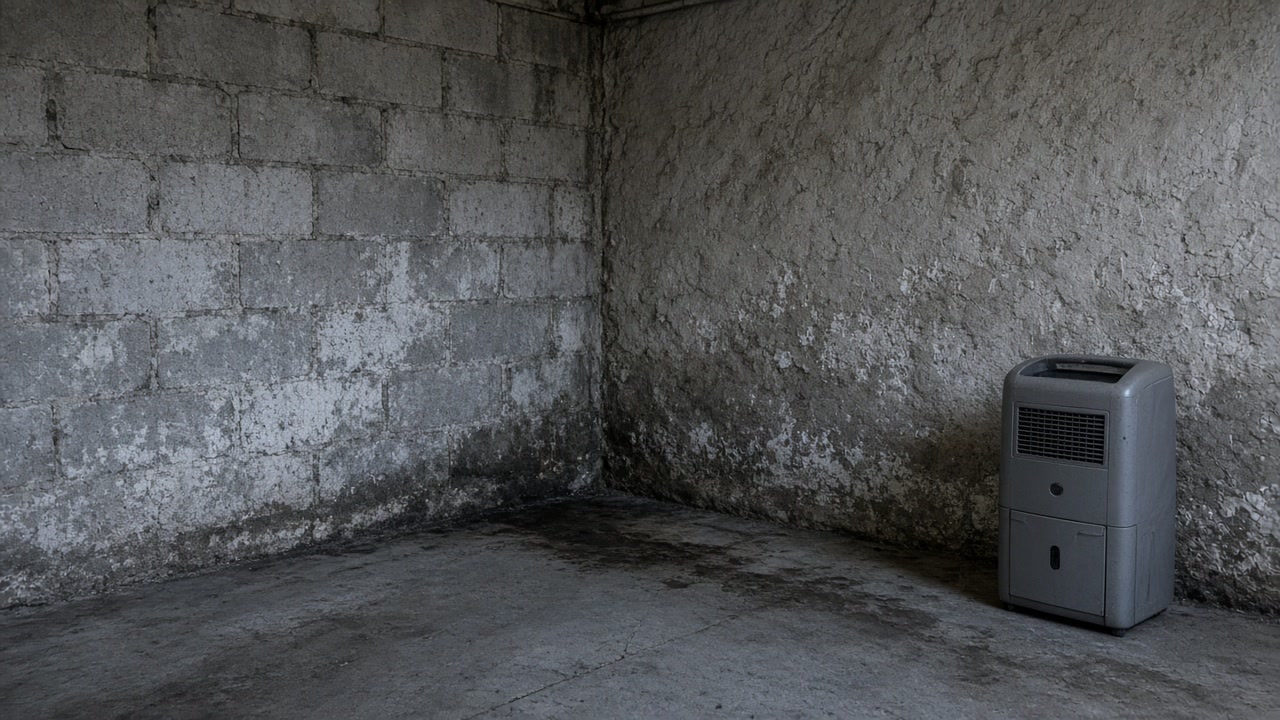
Because in the area the Village studied, the storm drainage runs out of capacity below a 1-year storm, which is the rain an ordinary year brings rather than a disaster. The engineers the Village of Scarsdale commissioned found the existing infrastructure grossly undersized to convey storms greater than a 1-year event and surcharging at multiple locations during one, so water that keeps coming back is the system behaving the way it was measured to behave, not evidence that you did something wrong.
Working out whether the water is yours or the street's
Write down the dates and the rainfall
You, from memory and a weather recordThe Village's modeling ties the surcharging it found to the frequent flooding residents already report, so a pattern of wet basements in modest storms is the expected result here rather than an oddity. Two dates in five years and two dates a year are different problems.
Go and look while it is still raining
You, with a coatThe studied channel runs roughly 1,740 feet from a culvert under Oak Lane to the Bronx River and crosses private driveways as well as public roads. Whether water is standing on the driveway and patio before it reaches the wall tells you a great deal about which side of the foundation the problem is on.
Read the humidity before you blame a leak
You, with a hygrometer that costs very littleThe state Department of Labor puts the indoor humidity mold typically needs above 55 percent. At Westchester County Airport the July dew point normal never drops below about 61F at any hour, so a cool below-grade room can condense water out of ordinary summer air with nothing leaking at all.
Get the moisture source written down
A licensed mold assessment contractorNew York requires the assessment licensee to give a written report to every client it assesses for compensation. That document is what turns an opinion about where the water comes from into something you can hand to a plumber, a mason or a buyer's attorney.
Split the building fault from the street condition
The assessor, with youOne of these is yours to fix and usually worth fixing. The other sits under the road or in a neighbor's driveway culvert and changes what is sensible to spend inside the house. Nobody can answer it from a map.
Decide what to rebuild, and to what standard
YouOwners in the Village's surveyed inundation area reported basement and garage flooding as common, with losses routinely up to $10,000 per event to repair and reconstruct finished below-grade space. That is what they told the Village they lost, and it is the reason the diagnosis comes before the drywall.
The order matters more than the speed. Everything above the last step is cheaper than everything below it, and the last step is the one most people buy first.
What a 1-year storm is, and why that one number is the whole story
A 1-year storm is not a rare event. It is roughly the rainfall intensity an ordinary year is expected to bring. The drainage study the Village of Scarsdale commissioned from Mott MacDonald for the Chesterfield Road and Fox Meadow Road area states that the existing drainage infrastructure is grossly undersized to convey storms greater than a 1-year storm event, and says that because of that finding the report focuses on the impacts associated with smaller storm events. That second sentence is the tell: the engineers narrowed their own study to small storms because the large ones were not the interesting case. Modeling the existing system across the 1, 2, 10, 25 and 100-year storms, they found the system has less than a 1-year storm capacity, with several sections exceeding capacity and surcharging during the 1-year storm, the 2-year results similar, and almost the entire system surcharging at 10 years or greater. Mold does not need a disaster. It needs water, something porous to sit in and time, and above all it needs the water to come back before the material has dried and been replaced. If the water is on an annual schedule, the drying is the easy half of the job.
Where the studied drainage runs, and whose land it crosses
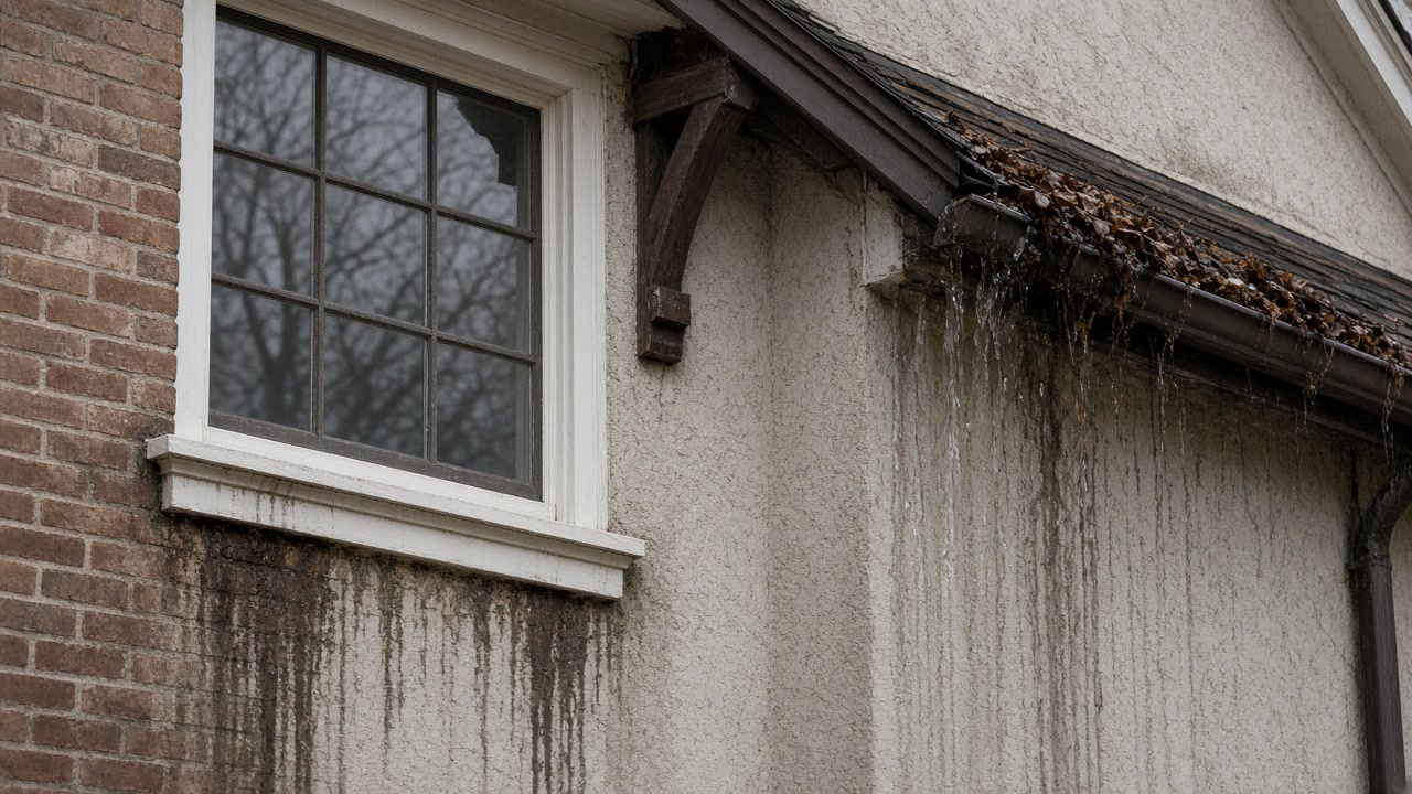
The report describes the studied system as an open channel with numerous culvert crossings under local roads and private driveways, which begins at a culvert under Oak Lane about 150 feet north of Chesterfield Road and running roughly 1,740 feet by way of Chesterfield Road, Fox Meadow Road and Butler Road before discharging into the Bronx River. Its finding on that stretch is that capacity from Oak Lane to the Bronx River was estimated to be less than the 1-year storm event before it begins to surcharge at multiple locations. The Brite Avenue side is better and still not good: the low-lying areas near Brite Avenue Park and Fox Meadow School are recorded as experiencing regular flooding and are drained by an existing 30 inch pipe running through private property, which the report says has approximately a 2-year storm capacity. The practical point for a homeowner is that part of what controls water on your lot may be a culvert on somebody else's driveway or a pipe in a private easement that nobody has looked inside for decades. That is worth establishing before you assume the problem is your foundation.
Ida is the explanation most people reach for, and it is the wrong one
FEMA declared DR-4615-NY for the remnants of Hurricane Ida over an incident period of September 1 to 3, 2021, with Westchester County a designated area, and the Village's own record of it includes damage at Village facilities, a culvert lost on Olmsted Road and numerous roads closed by flooding and downed trees. It was a genuinely large event and it is the one everybody remembers. That is exactly why it misleads. If you file the wet basement under Ida, you dry it, rebuild the same finishes and wait for the next hundred-year storm. The Village's own engineering says the system in the studied area surcharges in a 1-year storm, so Ida explains one bad night and not a recurring wet basement. Separately, the Village reported several recurring flood locations to the county, scoring two of them high: in the Brewster Road and Paddington Road area the report describes damage to thirty to fifty residential properties with water about three feet deep for up to 48 hours, and in the George Field Park area that backyards and basements flood except near Rugby Lane.
Being outside the mapped flood zone is weaker evidence than it sounds
FEMA's redacted National Flood Insurance Program claims data records 12,245 paid flood claims in Westchester County over the life of the program, about $272.4 million paid on building and contents combined, and 4,291 of those claims, about 35 percent, were rated in zones X, B or C, which sit outside the Special Flood Hazard Area. For Ida alone, 669 of 1,729 paid county claims, about 39 percent, were in those same zones. More than a third of the county's paid flood claims came from properties the maps do not treat as high risk, which is the statistic to keep in mind if a real estate listing or an insurance broker has told you the address is fine because it is out of the zone. It is also worth knowing that Scarsdale participates in the FEMA Community Rating System as a Class 8 community, which FEMA rates at a 10 percent discount applied to the full-risk premium for all NFIP policies in the participating community, including policies outside the Special Flood Hazard Area. Pricing a policy is cheap and takes an afternoon.
How many Scarsdale houses are in the same position as yours
The 2021 Westchester County Hazard Mitigation Plan reports FEMA data current as of July 2021 for the Village of Scarsdale: 347 flood insurance policies in force, 492 paid claims, $3,598,214.69 in total loss payments and 47 Repetitive Loss properties. The trend inside those numbers is the part worth reading. The December 2015 edition of the plan recorded 22 Repetitive Loss and 4 Severe Repetitive Loss properties as of March 31, 2014, against 307 claims paid since 1987 totaling $2,590,107. Repeat-claim properties in one small village more than doubled in roughly seven years while the number of households carrying a policy fell from 391 to 347. Fewer insured, more flooding repeatedly. If your basement has taken water more than once you are not an unlucky outlier here, and the useful question stops being whether it will happen again and becomes what specifically is letting it in.
Nobody can tell you from a public record whether your house floods
Asked by the county in 2021 whether it keeps a list of properties damaged by flooding, the Village of Scarsdale answered that at present it does not, adding that FEMA maintains a repetitive loss list which the Village receives as part of its Community Rating System participation. The Village also reported it has never had to make a substantial damage determination and that no properties have been mitigated by elevation or acquisition. So there is no searchable Village record of flooded addresses, and anybody who implies they know the flood history of your particular house is not reading one. This site will not pretend otherwise. Two towns nearby answer the question differently and it is worth knowing which you are in: the City of White Plains told the county it does maintain a list of flood damaged properties, the only one of the eight towns covered here to say so, and the Town-Village of Harrison answered that current FIRMs do not include some areas and that it plans its own town-specific flood map identifying riverine, precipitation, urban and overland flooding.
What the drainage report is, and what it is not
It is a study recommending alternatives and seeking mitigation funding, not a completed project. It evaluates Option 1, a new storm sewer along Chesterfield Road and Fox Meadow Road estimated at about $2,600,000, and Option 2 at about $2,000,000, reports a FEMA benefit-cost ratio of 1.1 for Option 1, and concludes the project would be eligible for federal funding assistance and grants which should be pursued by the Village. Two further alternatives, upgrading the 30 inch Brite Avenue pipe and a parallel system along Butler Road, were considered and abandoned as likely infeasible. Nothing in the public record says this work has been built. Plan on the drainage behaving as the study describes it today, and treat any claim that the problem has been solved with suspicion, including from anyone trying to sell you something on the strength of it.
Three checks worth doing yourself before you pay anybody
First, the humidity. The New York State Department of Labor lists what mold needs as water or moisture, typically indoor humidity above 55 percent, an organic food source and a temperature typically between 40F and 99F. At Westchester County Airport the NOAA 1991 to 2020 normals put the mean July dew point at 63.2F and never below about 61F at any hour of the month, so any basement surface cooler than that is condensing water out of ordinary summer air with no leak involved. A hygrometer answers that question for a few dollars. Second, the season. The same normals give about 90 nights a year below freezing across December to March with the daily maximum above freezing in every one of those months, which is what works a hairline foundation crack wider each winter, so a wall that is dry in October is not evidence about the same wall in April. Third, the scale. The Department of Labor is explicit that the mere presence of mold does not trigger any obligation to obtain an assessment or perform remediation, and that a residential property owner may lawfully do this work on their own property. A small patch on a cold wall after a humid August is often yours to clean and nothing more. Its other point is the one that costs people money: once you do pay somebody, they have to be licensed.
What changes once you know where the water is coming from
The EPA's position on timing is blunt: dry water-damaged areas and items within 24 to 48 hours to prevent mold growth, and if wet materials are dried inside that window then in most cases mold will not grow. In a Scarsdale basement that window frequently closes before anyone knows there was water, which is why the smell arrives before the discovery does. Once the source is known, the decisions get easier and cheaper in both directions. If it is a building fault, it is yours and fixing it is worth the money because it ends the cycle. If it is a street drainage condition of the kind the Village's own study describes, that changes what is sensible to spend on finishes below grade, and the honest advice may be to rebuild more simply rather than more expensively. Owners in the surveyed inundation area reported losses routinely up to $10,000 per event to repair and reconstruct finished basement space, and that was their own account to the Village, not a price for any service. If you want the source established in writing before you spend anything on finishes, send the details of what happened and when, and we will arrange the assessment first.
Sources used in this guide
The drainage study the Village of Scarsdale commissioned from Mott MacDonald for the Chesterfield Road and Fox Meadow Road area states that "The existing drainage infrastructure is grossly undersized to convey storms greater than a 1-year storm event", and that because of that finding "our report focuses on the impacts associated with smaller storm events". The engineers narrowed their own study to small storms because the large ones were not the interesting case.
Source: Mott MacDonald for the Village of Scarsdale, Brite Avenue and Fox Meadow Road Drainage Study, Final Watershed Report, DPW Project No. 22-012, accessed 2026-09-22
Modeling the existing system in SewerGEMS across the 1, 2, 10, 25 and 100-year storms, the same report found "the drainage system has less than a 1-year storm capacity with several sections of the system exceeding its capacity and surcharging/flooding during the 1-year storm event", and that during the 1-year storm the system "surcharges at multiple locations with several of the culvert crossings at capacity which is consistent with the reported frequent flooding that occurs within the project area". The 2-year results are "similar with the 1-year storm with the system surcharging at multiple locations", and "The results of the 10-year storm or greater show that almost the entire system surcharges."
Source: Mott MacDonald for the Village of Scarsdale, Brite Avenue and Fox Meadow Road Drainage Study, Final Watershed Report, DPW Project No. 22-012, accessed 2026-09-22
The report describes the studied system as an open channel with numerous culvert crossings under local roads and private driveways, beginning at a culvert under Oak Lane about 150 feet north of Chesterfield Road and running roughly 1,740 feet by way of Chesterfield Road, Fox Meadow Road and Butler Road before discharging into the Bronx River. Its body states: "The capacity of the main existing drainage system to convey flows from Oak Lane to the Bronx River was estimated to be less than the 1-year storm event before is begins to surcharge at multiple locations."
Source: Mott MacDonald for the Village of Scarsdale, Brite Avenue and Fox Meadow Road Drainage Study, Final Watershed Report, DPW Project No. 22-012, accessed 2026-09-22
The report records that the low-lying areas along Brite Avenue near Brite Avenue Park and Fox Meadow School "experience regular flooding" and are drained by an existing 30 inch pipe running through private property, a system the report says "has approximately a 2-year storm capacity".
Source: Mott MacDonald for the Village of Scarsdale, Brite Avenue and Fox Meadow Road Drainage Study, Final Watershed Report, DPW Project No. 22-012, accessed 2026-09-22
Through the Westchester County Stormwater Reconnaissance Plan process the Village reported several recurring flood locations to the county and scored two of them High. In the Brewster Road and Paddington Road area the respondent reported damage to thirty to fifty residential properties with water about three feet deep for up to 48 hours. In the George Field Park area "Backyards and basements flood in the George Field Park area except near Rugby Lane", with 30 to 40 residential properties reported damaged. On the other side of the village the Village reported that the upper Sheldrake River flooded "the back yards, driveways, garages and/or basements of about 30 to 40 single-family residences" in the April 2007 nor'easter, reaching depths of up to five feet, and that "Flooding of this nature has occurred about 10 times over the past decade and usually occurs when precipitation reaches three inches or more".
Source: Westchester County Department of Planning, December 2015 DMA 2000 Hazard Mitigation Plan Update, Section 9.41 Village of Scarsdale, accessed 2026-09-22
FEMA declared DR-4615-NY, "Remnants of Hurricane Ida", for an incident period of September 1 to 3, 2021, with Westchester County a designated area. The Village of Scarsdale's own entry in the 2021 county plan records damage at Village facilities, a culvert lost on Olmsted Road and numerous Village roads closed by flooding and downed trees.
Source: Federal Emergency Management Agency, OpenFEMA Disaster Declarations Summaries, accessed 2026-09-22
FEMA's redacted National Flood Insurance Program claims dataset records 12,245 paid flood insurance claims in Westchester County across the life of the program, about $272.4 million paid on building and contents combined, with the heaviest loss years 2021 at 1,829 claims, 2011 at 1,374 and 2007 at 1,346. Of those 12,245 claims, 4,291, about 35 percent, were rated in flood zones X, B or C, which sit outside the Special Flood Hazard Area. For Ida alone there were 1,729 paid county claims with dates of loss between September 1 and 4, 2021, totaling about $104.9 million, of which 669, about 39 percent, were rated in zones X, B or C.
Source: Federal Emergency Management Agency, OpenFEMA FIMA NFIP Redacted Claims, accessed 2026-09-22
Scarsdale joined the National Flood Insurance Program in 1987. Its current effective Flood Insurance Rate Maps are dated September 28, 2007, and its Flood Damage Prevention Ordinance is Chapter 167 of the Village Code, adopted September 25, 2007 and, per the 2021 county plan, last amended September 11, 2012. The Village participates in the FEMA Community Rating System as a Class 8 community, first classified October 18, 1998. FEMA applies a 10 percent discount at Class 8 and states that the discount "is applied to the full-risk premium for all NFIP policies in the Regular Program in a participating community, including policies outside of the Special Flood Hazard Area".
Source: Westchester County Department of Planning, 2021 Countywide Hazard Mitigation Plan, Section 9.43 Village of Scarsdale, and FEMA Community Rating System, accessed 2026-09-22
In the 2021 Westchester County Hazard Mitigation Plan, the Village of Scarsdale annex reports FEMA data current as of July 2021: 347 flood insurance policies in force, 492 paid claims, $3,598,214.69 in total loss payments and 47 Repetitive Loss properties.
Source: Westchester County Department of Planning, 2021 Countywide Hazard Mitigation Plan, Section 9.43 Village of Scarsdale, accessed 2026-09-22
Scarsdale's Repetitive Loss count more than doubled between the two published county plans. The December 2015 plan recorded 22 Repetitive Loss and 4 Severe Repetitive Loss properties as of March 31, 2014, with 307 claims paid since 1987 totaling $2,590,107. The 2021 plan records 47 Repetitive Loss properties and 492 claims totaling $3,598,214.69 as of July 2021.
Source: Westchester County Department of Planning, 2021 Countywide Hazard Mitigation Plan and the December 2015 DMA 2000 Hazard Mitigation Plan Update, Section 9.41 Village of Scarsdale, accessed 2026-09-22
Asked in the 2021 county plan whether it keeps a list of properties damaged by flooding, the Village of Scarsdale answered: "At present the Village does not keep a list of properties that have been damaged by flooding. However, FEMA maintains a list of properties that have experience repetitive loss and the Village received a copy of the list as part of our CRS participation." The Village also reported that it has never had to make a substantial damage determination, and that no properties have been mitigated by elevation or acquisition.
Source: Westchester County Department of Planning, 2021 Countywide Hazard Mitigation Plan, Section 9.43 Village of Scarsdale, accessed 2026-09-22
Asked in the 2021 county plan whether it keeps a list of properties damaged by flooding, the City of White Plains answered "The City maintains a list of flood damaged properties", and named its flood-prone areas: low lying areas of Cloverdale Avenue, Smith Avenue near Longview Avenue, a portion of Bloomingdale Road at the exit ramps of I-287, Brockway Place, a low lying area of Haarlem Avenue near Glenn Street, a section of Bronx River Parkway near Main Street bridge, and a low lying area of Central Westchester Parkway. It is the only one of the eight towns on this site that told the county it keeps such a list.
Source: Westchester County Department of Planning, 2021 Countywide Hazard Mitigation Plan, Section 9.6 City of White Plains, accessed 2026-09-22
Asked in the 2021 county plan whether its flood hazard maps adequately address the flood risk in its jurisdiction, the Town-Village of Harrison answered no: "Current FIRMs do not include some areas. The Town plans to expand flood mapping and establish a Town specific flood map that identifies all flooding sources (riverine, precipitation, urban, over land flooding) and use this improved mapping and data to update the Town/Village code." It also reported that it was finishing a Drainage Manual with a GIS map of problem areas.
Source: Westchester County Department of Planning, 2021 Countywide Hazard Mitigation Plan, Section 9.31 Town-Village of Harrison, accessed 2026-09-22
The report is a study recommending alternatives and seeking mitigation funding, not a completed project. It evaluates Option 1, a new storm sewer along Chesterfield Road and Fox Meadow Road estimated at about $2,600,000, and Option 2 at about $2,000,000, and reports a FEMA benefit-cost ratio of 1.1 for Option 1, concluding the project "would be eligible for Federal funding assistance and grants, which should be pursued by the Village". Two further alternatives, upgrading the 30 inch Brite Avenue pipe and a parallel system along Butler Road, were considered and abandoned as likely infeasible.
Source: Mott MacDonald for the Village of Scarsdale, Brite Avenue and Fox Meadow Road Drainage Study, Final Watershed Report, DPW Project No. 22-012, accessed 2026-09-22
At Westchester County Airport, the NOAA 1991-2020 hourly climate normals show a July dew point that never drops below about 61F at any hour of the month: the lowest hourly July dew point normal is 60.9F, the highest is 65.0F, and the monthly mean is 63.2F. August is similar, with a mean of 62.6F. The season turns sharply: the mean is 57.5F in June and 56.3F in September, and while every hour of July sits at or above 60F, only about 5 percent of September hours do.
Source: NOAA National Centers for Environmental Information, 1991-2020 Climate Normals, station USW00094745 Westchester County Airport, NY, accessed 2026-09-22
The NOAA 1991-2020 monthly normals for Westchester County Airport give an average of 26.1 nights in January, 23.3 in February, 18.6 in March and 22.1 in December with a minimum temperature below 32F, about 90 nights across those four months, while the normal daily maximum in every one of those months is above freezing, at 37.3F in January, 40.1F in February, 47.6F in March and 42.3F in December.
Source: NOAA National Centers for Environmental Information, 1991-2020 Climate Normals, station USW00094745 Westchester County Airport, NY, accessed 2026-09-22
The New York State Department of Labor states that "In most cases, air sampling and mold testing is unnecessary. There are currently no EPA or Federal standards for mold, so any interpretation of sampling results would not be based on any established health or environmental standard." It also states that mold needs water or moisture, typically indoor humidity above 55 percent, an organic food source and a temperature typically between 40F and 99F, and that "Mold can begin to develop and grow on damp surfaces within 24 to 48 hours".
Source: New York State Department of Labor, Mold Frequently Asked Questions, accessed 2026-09-22
The New York State Department of Labor states that "A Mold Project is defined as mold remediation, mold assessment, or mold abatement, of areas greater than ten (10) square feet undertaken for purpose of mold remediation or abatement", and that "The mere presence of mold does not trigger any obligation to obtain an assessment or perform remediation. However, if a property owner does elect to hire either an assessor or remediator, for the purposes of mold assessment or remediation, those individuals must be licensed and follow the requirements in the law." The first of its four licensing exemptions is "A residential property owner who performs mold inspection, assessment, remediation, or abatement on his or her own property"; the others cover non-residential owners of buildings of four or fewer dwelling units, owners and managing agents working on their own larger buildings provided they do not perform the work for the public, and governmental units and their employees. The Department states that consultants and contractors acting as agents of a governmental unit are not exempt.
Source: New York State Department of Labor, Mold Frequently Asked Questions, accessed 2026-09-22
The EPA states: "It is important to dry water-damaged areas and items within 24-48 hours to prevent mold growth", and "If wet or damp materials or areas are dried 24-48 hours after a leak or spill happens, in most cases mold will not grow." Its mold course adds that buildings and furnishings "must be dried or 'allowed to dry' quickly (within 24-48 hours) in order to avoid mold growth".
Source: United States Environmental Protection Agency, A Brief Guide to Mold, Moisture and Your Home, accessed 2026-09-22
In that same Village survey, "many property owners reported that they have had significant drainage issues from Tropical Storm Ida, or for lesser storm events, and sustained material losses", and the report records that "Basement and garage flooding reported routinely reported damages up to $10,000 per event." The report treats this as the cost "to repair/reconstruct finished basement spaces below grade".
Source: Mott MacDonald for the Village of Scarsdale, Brite Avenue and Fox Meadow Road Drainage Study, Final Watershed Report, DPW Project No. 22-012, accessed 2026-09-22
Services this guide relates to
Need someone to look at it?
Send the details and we will come back to you.